Subsets a coastline object according to limiting values for longitude and latitude.
Usage
# S4 method for class 'coastline'
subset(x, subset, ...)
Arguments
- x
a coastline object.
- subset
An expression indicating how to subset
x. See “Details”.- ...
optional additional arguments, the only one of which is considered is one named
debug, an integer that controls the level of debugging. If this is not supplied,debugis assumed to be 0, meaning no debugging. If it is 1, the steps of determining the bounding box are shown. If it is 2 or larger, then additional processing steps are shown, including the extraction of every polygon involved in the final result.
Details
As illustrated in the “Examples”, subset must be an expression that
indicates limits on both latitude and longitude. The individual elements
are provided in R notation, not mathematical notation, i.e. 30<latitude<60
is not permitted and ought to be written 30 < latitude & latitude < 60. The
simplest way to understand this is to copy the example directly, and then
modify the stated limits. Note that > comparison is not permitted, and that
< is converted to <= in the calculation. Similarly, && is converted to
&. Spaces in the expression are ignored. For convenience, longitude and
and latitude may be abbreviated as lon and lat, as in the
“Examples”.
See also
Other things related to coastline data:
[[,coastline-method,
[[<-,coastline-method,
as.coastline(),
coastline-class,
coastlineBest(),
coastlineCut(),
coastlineWorld,
download.coastline(),
plot,coastline-method,
read.coastline.openstreetmap(),
read.coastline.shapefile(),
summary,coastline-method
Other functions that subset oce objects:
subset,adp-method,
subset,adv-method,
subset,amsr-method,
subset,argo-method,
subset,cm-method,
subset,ctd-method,
subset,echosounder-method,
subset,lobo-method,
subset,met-method,
subset,oce-method,
subset,odf-method,
subset,rsk-method,
subset,sealevel-method,
subset,section-method,
subset,topo-method,
subset,xbt-method
Examples
library(oce)
data(coastlineWorld)
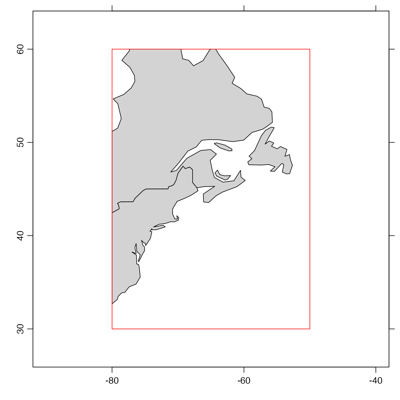
# Subset to a box centred on Nova Scotia, Canada
if (requireNamespace("sf")) {
cl <- subset(coastlineWorld, -80 < lon & lon <- 50 & 30 < lat & lat < 60)
# The plot demonstrates that the trimming is as requested.
plot(cl, clon = -65, clat = 45, span = 6000)
rect(-80, 30, -50, 60, bg = "transparent", border = "red")
}