Executive Summary. a transition of oce to sf will require the removal of healpix, nesper, pconic and rhealpix projections, all of which cause errors in sf. The loss of healpix, rhealpix and pconic projections is not of much concern, since these were interrupted projections that were not handled properly by oce::mapPlot() anyway (see http://dankelley.github.io/r/2020/01/04/oce-proj.html for the healpix and rhealpix examples; the nesper case was ignored in that blog item). The nesper projection seems unlikely to enjoy wide usage, since it is showing a near-earth satellite view. Thus, the loss of these 4 oce projections should not stand in the way of a transition from rgdal to sf \ldots and the benefits of switching to the newer sf package are convincing, in terms of accuracy and future availability.
Introduction
For several years, oce has used the rgdal::transform() function for
map-projection calculations. This cannot continue, given that the rgdal
developers intend to deprecate transform(). Lately, I have been exploring the
possibility of switching to sf::st_transform() for map-projection
calculations. This work is being done in the sf branch of oce. In the
present initial phase of the transition, calculations are done with both
rgdal::transform() and sf::st_transform(), and warnings are issued if the
results differ. (This requires version 0.8.1 of the st package, which is
presently only available on github.)
This blog posting tests the sf branch of oce against the projections used in
the 2015-04-03-oce-proj
posting. My quick scan
shows that this works as expected.
Note that this version of oce accepts lonlat and longlat as synonyms, and the same for latlon and latlong.
1
2
3
4
5
6
7
8
9
10
11
12
13
14
library(oce)
data(coastlineWorld)
cl45 <- coastlineCut(coastlineWorld, lon_0=-45)
par(mar=rep(2, 4))
line <- 0.25
pcol <- "blue"
ecol <- "red"
font <- 1
col <- "lightgray"
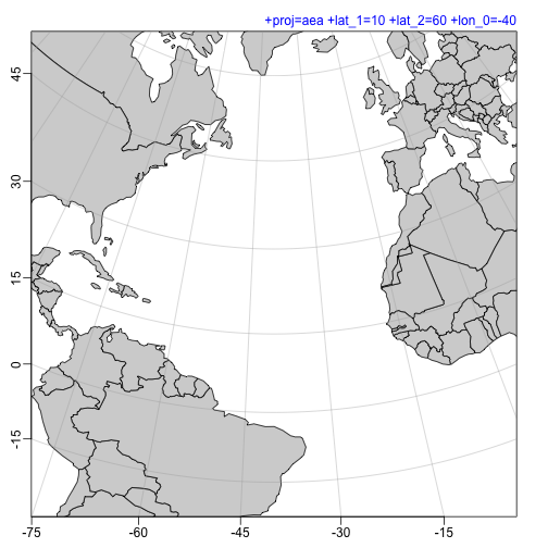
p <- "+proj=aea +lat_1=10 +lat_2=60 +lon_0=-40"
mapPlot(coastlineWorld, projection=p, longitudelim=c(-80,0), latitudelim=c(0,45), col=col)
mtext(p, line=line, adj=1, col=pcol, font=font)
1
2
3
4
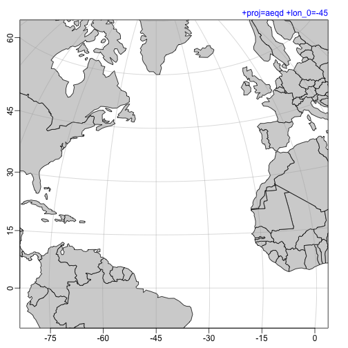
p <- "+proj=aeqd +lon_0=-45"
mapPlot(coastlineWorld, projection=p,
longitudelim=c(-80,0), latitudelim=c(0,60), col=col)
mtext(p, line=line, adj=1, col=pcol, font=font)
1
2
3
4
5
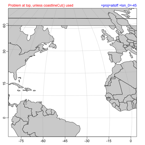
p <- "+proj=aitoff +lon_0=-45"
mapPlot(coastlineWorld, projection=p,
longitudelim=c(-80,0), latitudelim=c(0,60), col=col)
mtext(p, line=line, adj=1, col=pcol, font=font)
mtext("Problem at top, unless coastlineCut() used", line=line, adj=0, col=ecol, font=font)
1
2
3
4
5
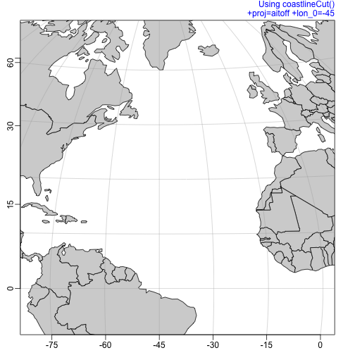
p <- "+proj=aitoff +lon_0=-45"
mapPlot(cl45, projection=p,
longitudelim=c(-80,0), latitudelim=c(0,60), col=col)
mtext(p, line=line, adj=1, col=pcol, font=font)
mtext("Using coastlineCut()", line=line+0.9, adj=1, col=pcol, font=font)
1
2
3
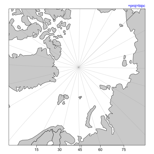
p <- "+proj=bipc"
mapPlot(coastlineWorld, projection=p, longitudelim=c(-80,0), latitudelim=c(70, 110), col=col)
mtext(p, line=line, adj=1, col=pcol, font=font)
1
2
3
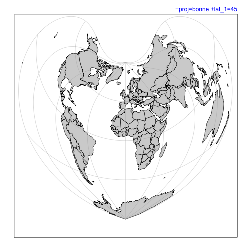
p <- "+proj=bonne +lat_1=45"
mapPlot(coastlineWorld, projection=p, col=col)
mtext(p, line=line, adj=1, col=pcol, font=font)
1
2
3
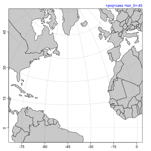
p <- "+proj=cass +lon_0=-45"
mapPlot(coastlineWorld, projection=p, longitudelim=c(-80,0), latitudelim=c(0,60), col=col)
mtext(p, line=line, adj=1, col=pcol, font=font)
1
2
3
4
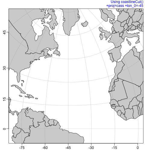
p <- "+proj=cass +lon_0=-45"
mapPlot(cl45, projection=p, longitudelim=c(-80,0), latitudelim=c(0,60), col=col)
mtext(p, line=line, adj=1, col=pcol, font=font)
mtext("Using coastlineCut()", line=line+0.9, adj=1, col=pcol, font=font)
1
2
3
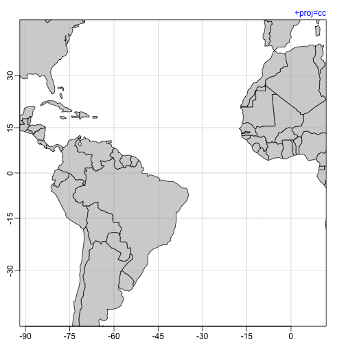
p <- "+proj=cc"
mapPlot(coastlineWorld, projection=p, longitudelim=c(-80,0), latitudelim=c(-40,40), col=col)
mtext(p, line=line, adj=1, col=pcol, font=font)
1
2
3
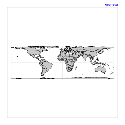
p <- "+proj=cea"
mapPlot(coastlineWorld, projection=p, col=col)
mtext(p, line=line, adj=1, col=pcol, font=font)
1
2
3
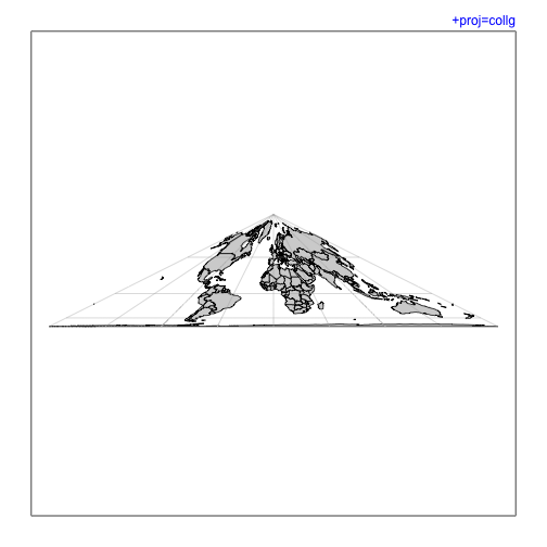
p <- "+proj=collg"
mapPlot(coastlineWorld, projection=p, col=col)
mtext(p, line=line, adj=1, col=pcol, font=font)
1
2
3
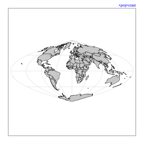
p <- "+proj=crast"
mapPlot(coastlineWorld, projection=p, col=col)
mtext(p, line=line, adj=1, col=pcol, font=font)
1
2
3
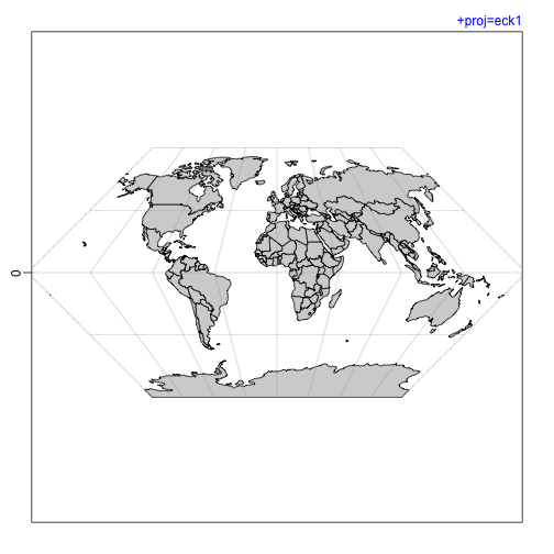
p <- "+proj=eck1"
mapPlot(coastlineWorld, projection=p, col=col)
mtext(p, line=line, adj=1, col=pcol, font=font)
1
2
3
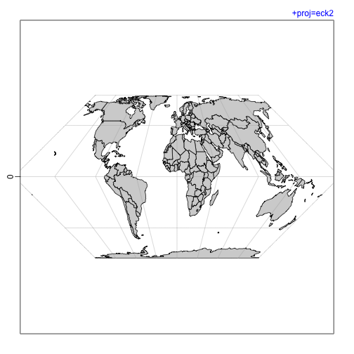
p <- "+proj=eck2"
mapPlot(coastlineWorld, projection=p, col=col)
mtext(p, line=line, adj=1, col=pcol, font=font)
1
2
3
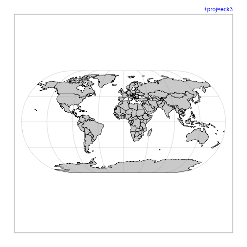
p <- "+proj=eck3"
mapPlot(coastlineWorld, projection=p, col=col)
mtext(p, line=line, adj=1, col=pcol, font=font)
1
2
3
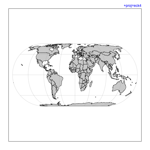
p <- "+proj=eck4"
mapPlot(coastlineWorld, projection=p, col=col)
mtext(p, line=line, adj=1, col=pcol, font=font)
1
2
3
p <- "+proj=eck5"
mapPlot(coastlineWorld, projection=p, col=col)
mtext(p, line=line, adj=1, col=pcol, font=font)

1
2
3
p <- "+proj=eck6"
mapPlot(coastlineWorld, projection=p, col=col)
mtext(p, line=line, adj=1, col=pcol, font=font)

1
2
3
p <- "+proj=eqc"
mapPlot(coastlineWorld, projection=p, col=col)
mtext(p, line=line, adj=1, col=pcol, font=font)

1
2
p <- "+proj=eqearth"
mapPlot(coastlineWorld, projection=p, col=col)
## Warning in CPL_crs_parameters(x): GDAL Error 1: PROJ: proj_as_wkt: Unsupported
## conversion method: Equal Earth
## Warning in CPL_crs_parameters(x): GDAL Error 1: PROJ: proj_as_wkt: Unsupported
## conversion method: Equal Earth1
mtext(p, line=line, adj=1, col=pcol, font=font)

1
2
3
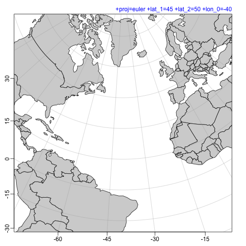
p <- "+proj=euler +lat_1=45 +lat_2=50 +lon_0=-40"
mapPlot(coastlineWorld, projection=p, longitudelim=c(-80, 0), latitudelim=c(0, 60), col=col)
mtext(p, line=line, adj=1, col=pcol, font=font)
1
2
3
p <- "+proj=etmerc +ellps=WGS84 +lon_0=-40"
mapPlot(coastlineWorld, projection=p, longitudelim=c(-80, 0), latitudelim=c(0, 60), col=col)
mtext(p, line=line, adj=1, col=pcol, font=font)

1
2
3
4
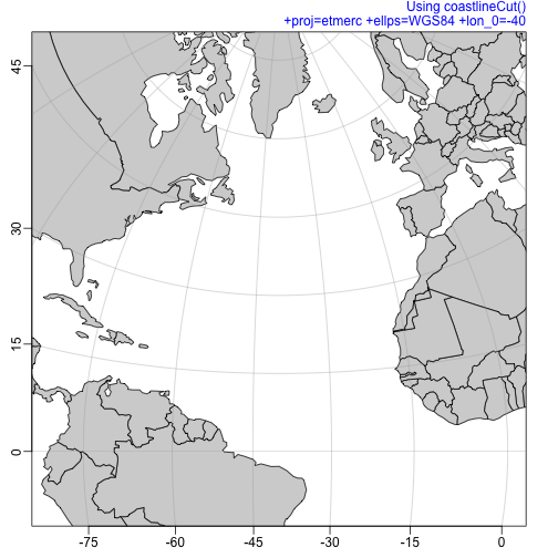
p <- "+proj=etmerc +ellps=WGS84 +lon_0=-40"
mapPlot(cl45, projection=p, longitudelim=c(-80, 0), latitudelim=c(0, 60), col=col)
mtext(p, line=line, adj=1, col=pcol, font=font)
mtext("Using coastlineCut()", line=line+0.9, adj=1, col=pcol, font=font)
1
2
3
4
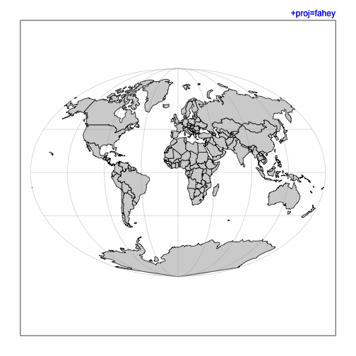
p <- "+proj=fahey"
mapPlot(coastlineWorld, projection=p, col=col)
mtext("+proj=fahey", line=line, adj=1, col=pcol, font=font)
mtext(p, line=line, adj=1, col=pcol, font=font)
1
2
3
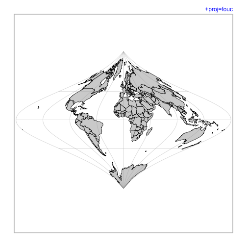
p <- "+proj=fouc"
mapPlot(coastlineWorld, projection=p, col=col)
mtext(p, line=line, adj=1, col=pcol, font=font)
1
2
3
p <- "+proj=fouc_s"
mapPlot(coastlineWorld, projection=p, col=col)
mtext(p, line=line, adj=1, col=pcol, font=font)

1
2
3
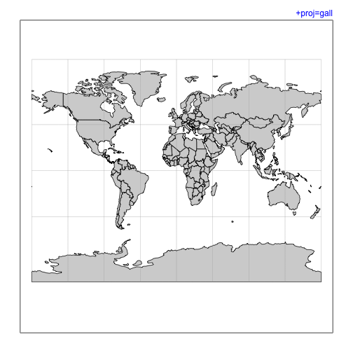
p <- "+proj=gall"
mapPlot(coastlineWorld, projection=p, col=col)
mtext(p, line=line, adj=1, col=pcol, font=font)
1
2
3
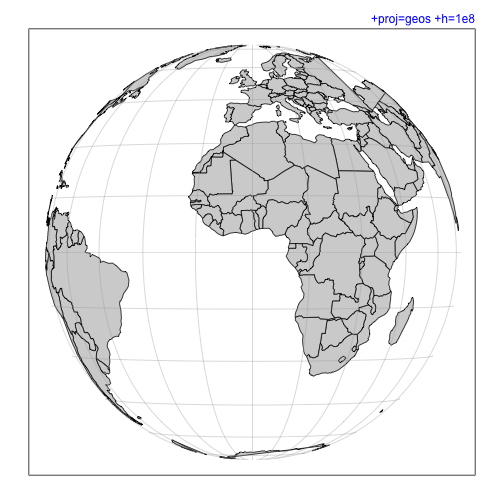
p <- "+proj=geos +h=1e8"
mapPlot(coastlineWorld, projection=p, col=col)
mtext(p, line=line, adj=1, col=pcol, font=font)
1
2
3
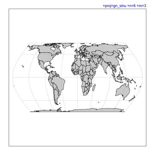
p <- "+proj=gn_sinu +n=6 +m=3"
mapPlot(coastlineWorld, projection=p, col=col)
mtext(p, line=line, adj=1, col=pcol, font=font)
1
2
3
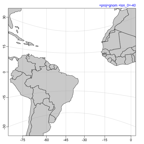
p <- "+proj=gnom +lon_0=-40"
mapPlot(coastlineWorld, projection=p, longitudelim=c(-80,0), latitudelim=c(-30,30), col=col)
mtext(p, line=line, adj=1, col=pcol, font=font)
1
2
3
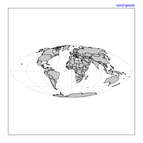
p <- "+proj=goode"
mapPlot(coastlineWorld, projection=p, col=col)
mtext(p, line=line, adj=1, col=pcol, font=font)
1
2
3
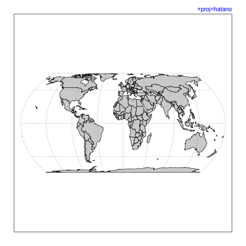
p <- "+proj=hatano"
mapPlot(coastlineWorld, projection=p, col=col)
mtext(p, line=line, adj=1, col=pcol, font=font)
1
2
3
4
5
6
7
8
9
10
11
12
13
14
## fails 2020-08-02 ## p <- "+proj=healpix +a=1"
## fails 2020-08-02 ## mapPlot(coastlineWorld, projection=p, col=col)
## fails 2020-08-02 ## mtext(p, line=line, adj=1, col=pcol, font=font)
## fails 2020-08-02 ## mtext("Problem in Canada", line=line, adj=0, col=ecol, font=font)
## fails 2020-08-02 ## p <- "+proj=rhealpix +south_square=0 +north_square=1"
## fails 2020-08-02 ## mapPlot(coastlineWorld, projection=p)
## fails 2020-08-02 ## mtext(p, line=line, adj=1, col=pcol, font=font)
## fails 2020-08-02 ## mtext("Is this an acid trip?", line=line, adj=0, col=ecol, font=font)
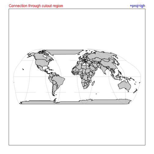
p <- "+proj=igh"
mapPlot(coastlineWorld, projection=p, col=col)
mtext(p, line=line, adj=1, col=pcol, font=font)
mtext("Connection through cutout region", line=line, adj=0, col=ecol, font=font)
1
2
3
p <- "+proj=kav5"
mapPlot(coastlineWorld, projection=p, col=col)
mtext(p, line=line, adj=1, col=pcol, font=font)

1
2
3
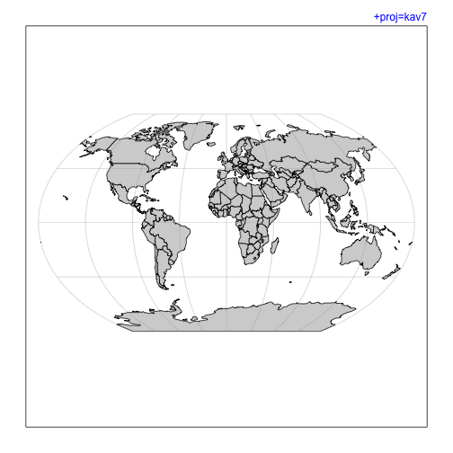
p <- "+proj=kav7"
mapPlot(coastlineWorld, projection=p, col=col)
mtext(p, line=line, adj=1, col=pcol, font=font)
1
2
3
p <- "+proj=laea +lon_0=-40"
mapPlot(coastlineWorld, projection=p, col=col)
mtext("+proj=laea +lon_0=-40", line=line, adj=1, col=pcol, font=font)
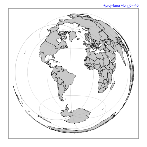
1
2
3
p <- "+proj=longlat"
mapPlot(coastlineWorld, projection=p, col=col)
mtext("+proj=lonlat", line=line, adj=1, col=pcol, font=font)

1
2
3
p <- "+proj=latlong"
mapPlot(coastlineWorld, projection=p, col=col)
mtext("+proj=lonlat", line=line, adj=1, col=pcol, font=font)
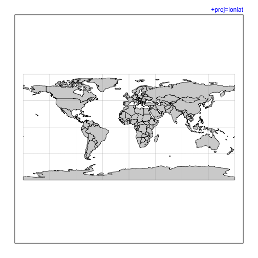
1
2
3
p <- "+proj=lcc +lat_1=30 +lat_2=70 +lon_0=-40"
mapPlot(coastlineWorld, projection=p, longitudelim=c(-80, 0), latitudelim=c(0, 60), col=col)
mtext(p, line=line, adj=1, col=pcol, font=font)
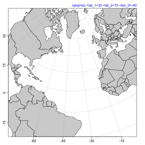
1
2
3
p <- "+proj=leac +lon_0=-40"
mapPlot(coastlineWorld, projection=p, longitudelim=c(-80, 0), latitudelim=c(0, 60), col=col)
mtext(p, line=line, adj=1, col=pcol, font=font)
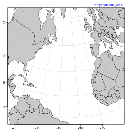
1
2
3
p <- "+proj=loxim"
mapPlot(coastlineWorld, projection=p, col=col)
mtext(p, line=line, adj=1, col=pcol, font=font)

1
2
3
p <- "+proj=mbt_s"
mapPlot(coastlineWorld, projection=p, col=col)
mtext(p, line=line, adj=1, col=pcol, font=font)

1
2
3
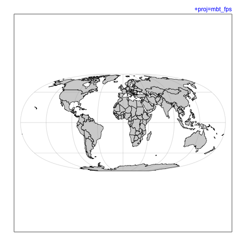
p <- "+proj=mbt_fps"
mapPlot(coastlineWorld, projection=p, col=col)
mtext(p, line=line, adj=1, col=pcol, font=font)
1
2
3
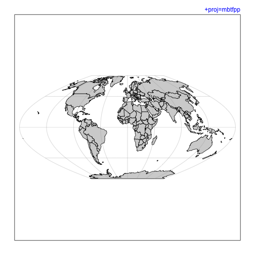
p <- "+proj=mbtfpp"
mapPlot(coastlineWorld, projection=p, col=col)
mtext(p, line=line, adj=1, col=pcol, font=font)
1
2
3
p <- "+proj=mbtfpq"
mapPlot(coastlineWorld, projection=p, col=col)
mtext(p, line=line, adj=1, col=pcol, font=font)

1
2
3
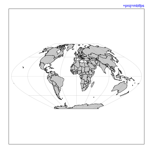
p <- "+proj=mbtfps"
mapPlot(coastlineWorld, projection=p, col=col)
mtext(p, line=line, adj=1, col=pcol, font=font)
1
2
3
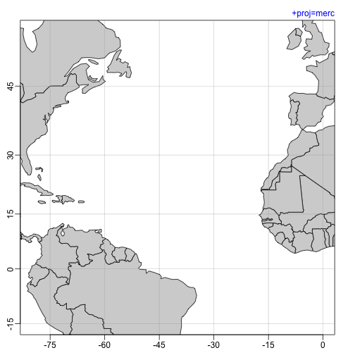
p <- "+proj=merc"
mapPlot(coastlineWorld, projection=p, longitudelim=c(-80,0), latitudelim=c(0,45), col=col)
mtext(p, line=line, adj=1, col=pcol, font=font)
1
2
3
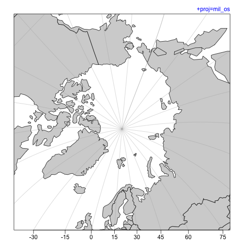
p <- "+proj=mil_os"
mapPlot(coastlineWorld, projection=p, longitudelim=c(-80,0), latitudelim=c(70, 120), col=col)
mtext(p, line=line, adj=1, col=pcol, font=font)
1
2
3
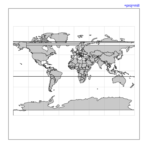
p <- "+proj=mill"
mapPlot(coastlineWorld, projection=p, col=col)
mtext(p, line=line, adj=1, col=pcol, font=font)
1
2
3
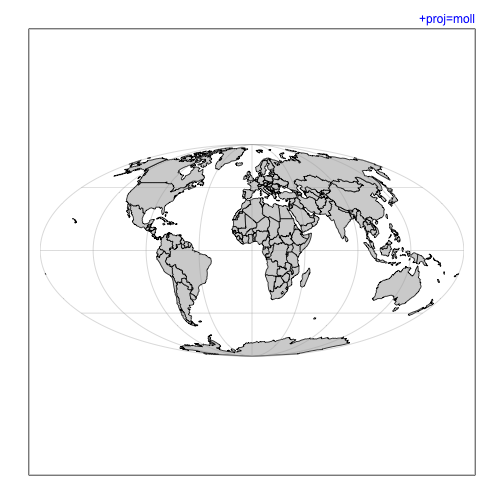
p <- "+proj=moll"
mapPlot(coastlineWorld, projection=p, col=col)
mtext(p, line=line, adj=1, col=pcol, font=font)
1
2
3
p <- "+proj=murd1 +lat_1=30 +lat_2=60 +lon_0=-40"
mapPlot(coastlineWorld, projection=p, longitudelim=c(-80,0), latitudelim=c(0,45), col=col)
mtext(p, line=line, adj=1, col=pcol, font=font)

1
2
3
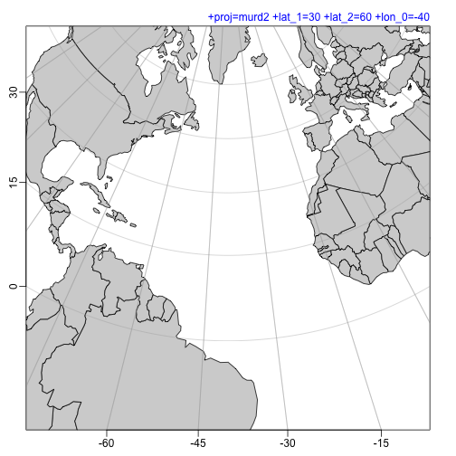
p <- "+proj=murd2 +lat_1=30 +lat_2=60 +lon_0=-40"
mapPlot(coastlineWorld, projection=p, longitudelim=c(-80,0), latitudelim=c(0,45), col=col)
mtext(p, line=line, adj=1, col=pcol, font=font)
1
2
3
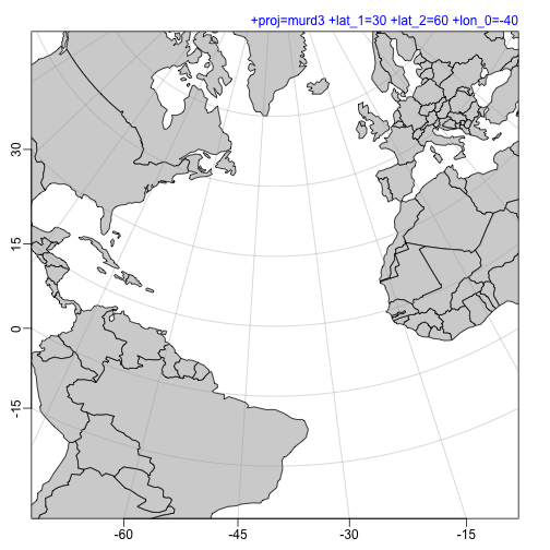
p <- "+proj=murd3 +lat_1=30 +lat_2=60 +lon_0=-40"
mapPlot(coastlineWorld, projection=p, longitudelim=c(-80,0), latitudelim=c(0,45), col=col)
mtext(p, line=line, adj=1, col=pcol, font=font)
1
2
3
p <- "+proj=natearth"
mapPlot(coastlineWorld, projection=p, col=col)
mtext(p, line=line, adj=1, col=pcol, font=font)

1
2
3
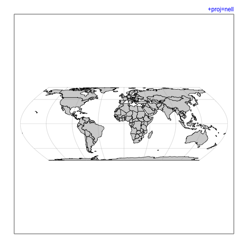
p <- "+proj=nell"
mapPlot(coastlineWorld, projection=p, col=col)
mtext(p, line=line, adj=1, col=pcol, font=font)
1
2
3
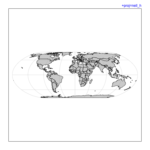
p <- "+proj=nell_h"
mapPlot(coastlineWorld, projection=p, col=col)
mtext(p, line=line, adj=1, col=pcol, font=font)
1
2
3
4
5
6
7
8
## fails 2020-08-02 ## p <- "+proj=nsper +h=90000000"
## fails 2020-08-02 ## mapPlot(coastlineWorld, projection=p, col=col)
## fails 2020-08-02 ## mtext(p, line=line, adj=1, col=pcol, font=font)
## fails 2020-08-02 ## mtext("Problem in Antarctica", line=line, adj=0, col=ecol, font=font)
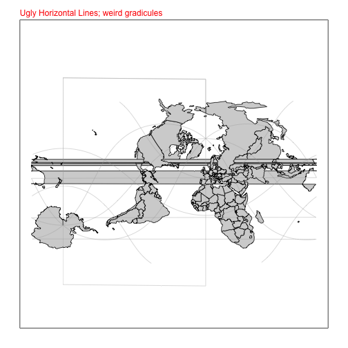
p <- "+proj=ob_tran +o_proj=mill +o_lon_p=40 +o_lat_p=50"
mapPlot(coastlineWorld, projection=p, col=col)
mtext("Ugly Horizontal Lines; weird gradicules", line=line, adj=0, col=ecol, font=font)
1
2
3
4
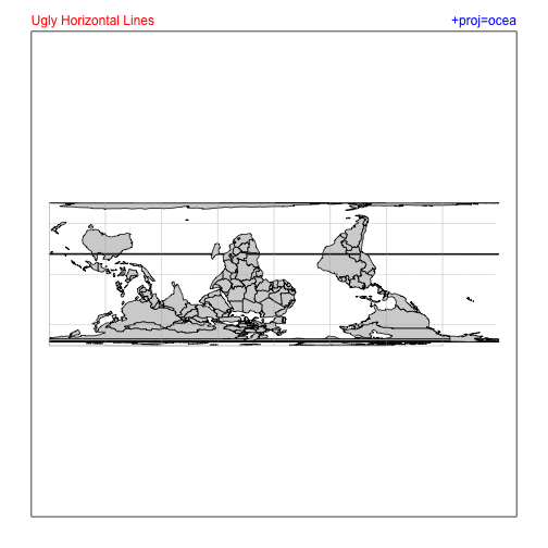
p <- "+proj=ocea"
mapPlot(coastlineWorld, projection=p, col=col)
mtext(p, line=line, adj=1, col=pcol, font=font)
mtext("Ugly Horizontal Lines", line=line, adj=0, col=ecol, font=font)
1
2
3
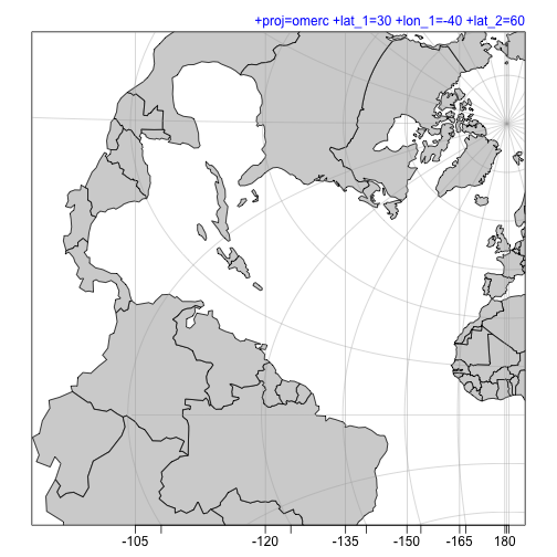
p <- "+proj=omerc +lat_1=30 +lon_1=-40 +lat_2=60"
mapPlot(coastlineWorld, projection=p, longitudelim=c(-80,0), latitudelim=c(0,60), col=col)
mtext(p, line=line, adj=1, col=pcol, font=font)
1
2
3
4
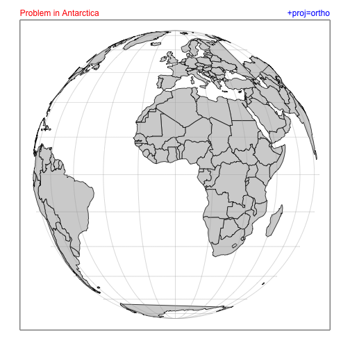
p <- "+proj=ortho"
mapPlot(coastlineWorld, projection=p, col=col)
mtext(p, line=line, adj=1, col=pcol, font=font)
mtext("Problem in Antarctica", line=line, adj=0, col=ecol, font=font)
1
2
3
4
5
6
7
8
## fails 2020-08-02 ## > p <- "+proj=pconic +lat_1=20 +lat_2=60 +lon_0=-40"
## fails 2020-08-02 ## > mapPlot(coastlineWorld, projection=p, longitudelim=c(-80,0), latitudelim=c(0,60), col=col)
## fails 2020-08-02 ## Error in CPL_geos_op2(op, x, y) :
## fails 2020-08-02 ## Evaluation error: TopologyException: found non-noded intersection between LINESTRING (2.90185e+06 6.38497e+07, 3.59738e+06 7.62361e+07) and LINESTRING (2.42138e+07 4.43386e+08, -699901 -292340) at 2901848.262176008 63849691.953739122.
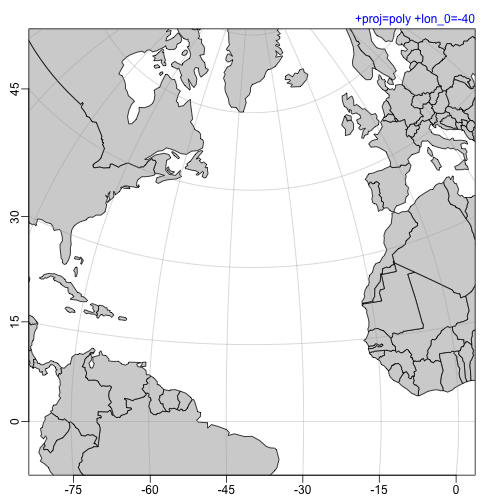
p <- "+proj=poly +lon_0=-40"
mapPlot(coastlineWorld, projection=p, longitudelim=c(-80,0), latitudelim=c(0,60), col=col)
mtext(p, line=line, adj=1, col=pcol, font=font)
1
2
3
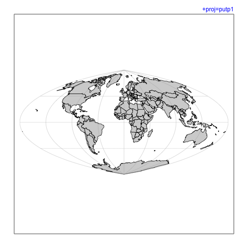
p <- "+proj=putp1"
mapPlot(coastlineWorld, projection=p, col=col)
mtext(p, line=line, adj=1, col=pcol, font=font)
1
2
3
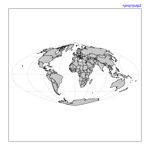
p <- "+proj=putp2"
mapPlot(coastlineWorld, projection=p, col=col)
mtext(p, line=line, adj=1, col=pcol, font=font)
1
2
3
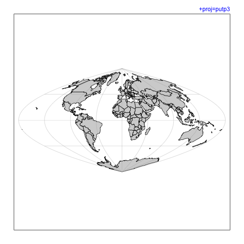
p <- "+proj=putp3"
mapPlot(coastlineWorld, projection=p, col=col)
mtext(p, line=line, adj=1, col=pcol, font=font)
1
2
3
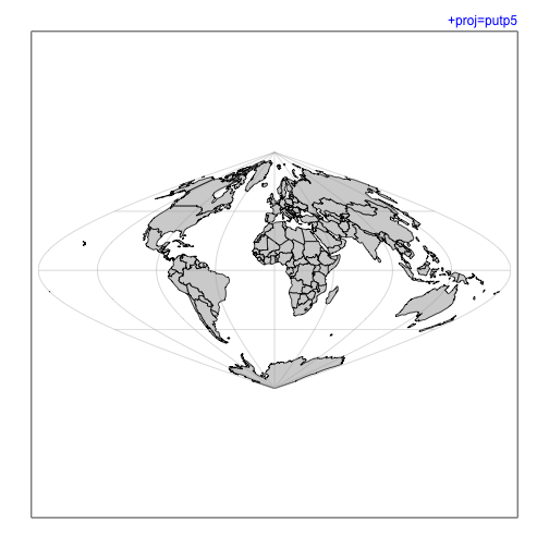
p <- "+proj=putp5"
mapPlot(coastlineWorld, projection=p, col=col)
mtext(p, line=line, adj=1, col=pcol, font=font)
1
2
3
p <- "+proj=putp6"
mapPlot(coastlineWorld, projection=p, col=col)
mtext(p, line=line, adj=1, col=pcol, font=font)

1
2
3
p <- "+proj=putp3p"
mapPlot(coastlineWorld, projection=p, col=col)
mtext(p, line=line, adj=1, col=pcol, font=font)

1
2
3
p <- "+proj=putp5p"
mapPlot(coastlineWorld, projection=p, col=col)
mtext(p, line=line, adj=1, col=pcol, font=font)

1
2
3
p <- "+proj=putp6p"
mapPlot(coastlineWorld, projection=p, col=col)
mtext(p, line=line, adj=1, col=pcol, font=font)

1
2
3
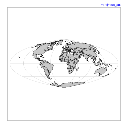
p <- "+proj=qua_aut"
mapPlot(coastlineWorld, projection=p, col=col)
mtext(p, line=line, adj=1, col=pcol, font=font)
1
2
3
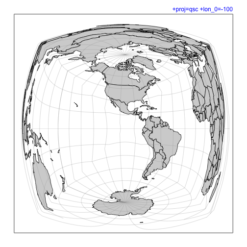
p <- "+proj=qsc +lon_0=-100"
mapPlot(coastlineWorld, projection=p, grid=15, col=col)
mtext(p, line=line, adj=1, col=pcol, font=font)
1
2
3
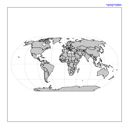
p <- "+proj=robin"
mapPlot(coastlineWorld, projection=p, col=col)
mtext(p, line=line, adj=1, col=pcol, font=font)
1
2
3
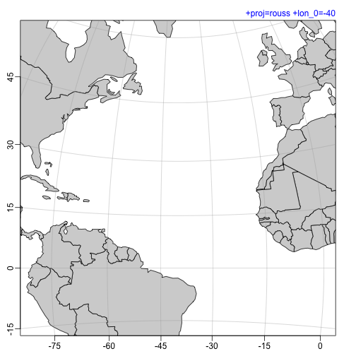
p <- "+proj=rouss +lon_0=-40"
mapPlot(coastlineWorld, projection=p, longitudelim=c(-80,0), latitudelim=c(0,45), col=col)
mtext(p, line=line, adj=1, col=pcol, font=font)
1
2
3
p <- "+proj=sinu"
mapPlot(coastlineWorld, projection=p, col=col)
mtext(p, line=line, adj=1, col=pcol, font=font)

1
2
3
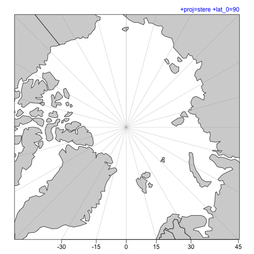
p <- "+proj=stere +lat_0=90"
mapPlot(coastlineWorld, projection=p, longitudelim=c(-80,0), latitudelim=c(70, 110), col=col)
mtext(p, line=line, adj=1, col=pcol, font=font)
1
2
3
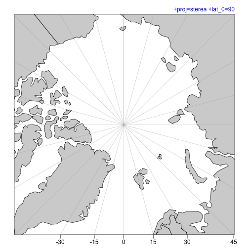
p <- "+proj=sterea +lat_0=90"
mapPlot(coastlineWorld, projection=p, longitudelim=c(-80,0), latitudelim=c(70, 110), col=col)
mtext(p, line=line, adj=1, col=pcol, font=font)
1
2
3
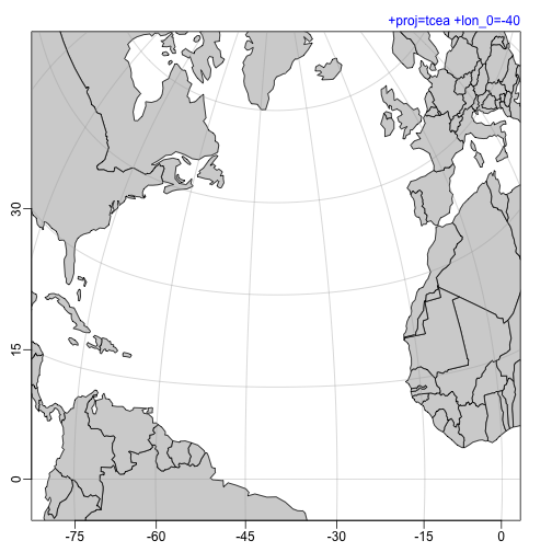
p <- "+proj=tcea +lon_0=-40"
mapPlot(coastlineWorld, projection=p, longitudelim=c(-80,0), latitudelim=c(0,60), col=col)
mtext(p, line=line, adj=1, col=pcol, font=font)
1
2
3
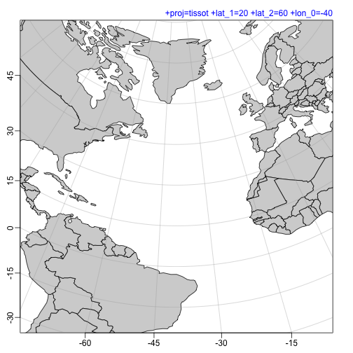
p <- "+proj=tissot +lat_1=20 +lat_2=60 +lon_0=-40"
mapPlot(coastlineWorld, projection=p, longitudelim=c(-80,0), latitudelim=c(0,60), col=col)
mtext(p, line=line, adj=1, col=pcol, font=font)
1
2
3
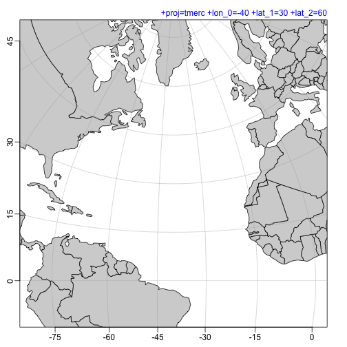
p <- "+proj=tmerc +lon_0=-40 +lat_1=30 +lat_2=60"
mapPlot(coastlineWorld, projection=p, longitudelim=c(-80,0), latitudelim=c(0,60), col=col)
mtext(p, line=line, adj=1, col=pcol, font=font)
1
2
3
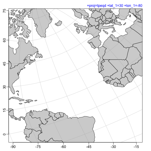
p <- "+proj=tpeqd +lat_1=30 +lon_1=-80"
mapPlot(coastlineWorld, projection=p, longitudelim=c(-80,0), latitudelim=c(0,60), col=col)
mtext(p, line=line, adj=1, col=pcol, font=font)
1
2
3
4
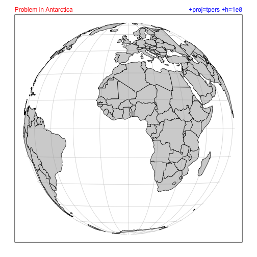
p <- "+proj=tpers +h=1e8"
mapPlot(coastlineWorld, projection=p, col=col)
mtext(p, line=line, adj=1, col=pcol, font=font)
mtext("Problem in Antarctica", line=line, adj=0, col=ecol, font=font)
1
2
3
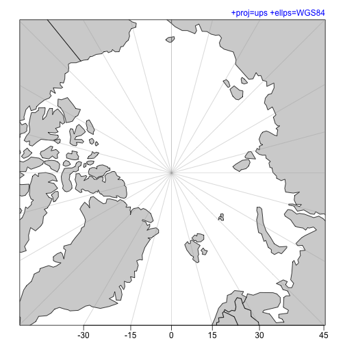
p <- "+proj=ups +ellps=WGS84"
mapPlot(coastlineWorld, projection=p, longitudelim=c(-80,0), latitudelim=c(70, 110), col=col)
mtext(p, line=line, adj=1, col=pcol, font=font)
1
2
3
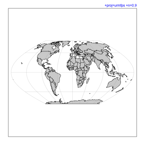
p <- "+proj=urmfps +n=0.9"
mapPlot(coastlineWorld, projection=p, col=col)
mtext(p, line=line, adj=1, col=pcol, font=font)
1
2
3
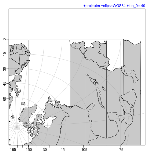
p <- "+proj=utm +ellps=WGS84 +lon_0=-40"
mapPlot(coastlineWorld, projection=p, longitudelim=c(-80,0), latitudelim=c(0,45), col=col)
mtext(p, line=line, adj=1, col=pcol, font=font)
1
2
3
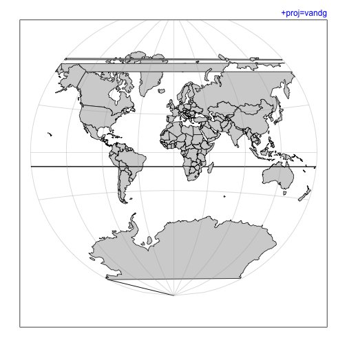
p <- "+proj=vandg"
mapPlot(coastlineWorld, projection=p, col=col)
mtext(p, line=line, adj=1, col=pcol, font=font)
1
2
3
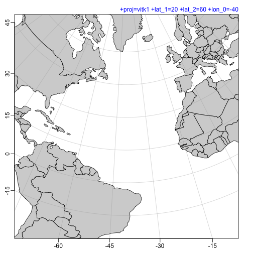
p <- "+proj=vitk1 +lat_1=20 +lat_2=60 +lon_0=-40"
mapPlot(coastlineWorld, projection=p, longitudelim=c(-80,0), latitudelim=c(0,45), col=col)
mtext(p, line=line, adj=1, col=pcol, font=font)
1
2
3
p <- "+proj=wag1"
mapPlot(coastlineWorld, projection=p, col=col)
mtext(p, line=line, adj=1, col=pcol, font=font)

1
2
3
p <- "+proj=wag2"
mapPlot(coastlineWorld, projection=p, col=col)
mtext(p, line=line, adj=1, col=pcol, font=font)

1
2
3
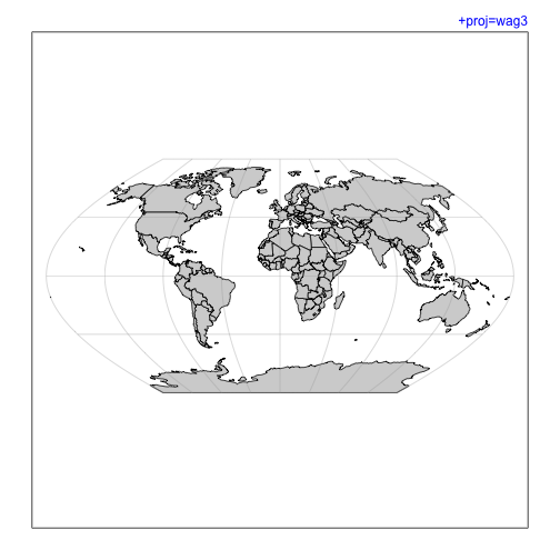
p <- "+proj=wag3"
mapPlot(coastlineWorld, projection=p, col=col)
mtext(p, line=line, adj=1, col=pcol, font=font)
1
2
3
p <- "+proj=wag4"
mapPlot(coastlineWorld, projection=p, col=col)
mtext(p, line=line, adj=1, col=pcol, font=font)

1
2
3
p <- "+proj=wag5"
mapPlot(coastlineWorld, projection=p, col=col)
mtext(p, line=line, adj=1, col=pcol, font=font)

1
2
3
p <- "+proj=wag6"
mapPlot(coastlineWorld, projection=p, col=col)
mtext(p, line=line, adj=1, col=pcol, font=font)

1
2
3
p <- "+proj=weren"
mapPlot(coastlineWorld, projection=p, col=col)
mtext(p, line=line, adj=1, col=pcol, font=font)

1
2
3
p <- "+proj=wink1"
mapPlot(coastlineWorld, projection=p, col=col)
mtext(p, line=line, adj=1, col=pcol, font=font)

1
2
3
p <- "+proj=wintri"
mapPlot(coastlineWorld, projection=p, col=col)
mtext(p, line=line, adj=1, col=pcol, font=font)

References and resources
-
Jekyll source code for this blog entry: 2020-01-04-oce-proj.Rmd